How India Recovered Monsoon Surplus in July After June Deficit
India’s 2026 monsoon season began under a cloud of concern. June ended with one of the largest rainfall shortfalls in more than a century, and official forecasts pointed to a below-normal July. Yet by the end of the month the picture had changed markedly. A succession of active weather systems erased the July deficit and sharply reduced the cumulative seasonal shortfall. Understanding how this turnaround occurred requires looking beyond the initial outlook to the specific atmospheric features that dominated the month.
A Difficult Start in June
June 2026 delivered roughly 37 to 40 percent less rain than the long-period average, ranking among the five driest Junes since reliable records began in 1901. The absence of low-pressure systems over the Bay of Bengal was a key factor. Normally, two or three such systems help distribute moisture inland during the month. Their non-appearance left large parts of the country dry. A developing El Niño in the Pacific and an unfavourable phase of the Madden-Julian Oscillation further suppressed organised rainfall.
The India Meteorological Department responded with a cautious outlook for July, projecting rainfall below 94 percent of the long-period average. Given that July typically contributes about one-third of the total monsoon rainfall and coincides with the peak kharif sowing period, the forecast raised legitimate worries about agriculture, reservoir levels, and water availability.
The Unexpected Turnaround
Contrary to the below-normal expectation, July rainfall recovered strongly. By late in the month the national figure for July stood near normal or slightly above the long-period average in several assessments, effectively wiping out the monthly deficit. Cumulative rainfall from the start of the season improved from a roughly 40 percent shortfall at the end of June to around 13 to 16 percent by the end of July.
The recovery was not uniform. Central India and parts of western India, including Gujarat and Maharashtra, received substantial excess rain. Northwest India improved considerably. In contrast, the east and northeast continued to report significant deficits, and some southern areas also lagged. The national improvement therefore reflected intense rainfall concentrated in certain regions rather than evenly distributed showers.
Low-Pressure Systems as the Main Driver
The primary reason for the rebound was the frequent formation and movement of low-pressure systems. July 2026 saw four such systems, two of which intensified into deep depressions. These systems affected the country on approximately 24 days—double the typical number for the month and the highest count since 2017.
Many of the systems originated over the Bay of Bengal and tracked westward across the peninsula. Their slow movement allowed prolonged rainfall over central and western India. One notable system moved from the Bay across Odisha toward Gujarat and Rajasthan, delivering widespread heavy rain. The interaction of these monsoon lows with western disturbances further enhanced moisture and precipitation over northern and western regions.
This succession of systems effectively compensated for the dry June. Where June had lacked organised rain-bearing features, July was characterised by repeated pulses of moisture and convergence.
Additional Influences Beyond the Forecast
While El Niño conditions were expected to suppress rainfall, other factors appear to have moderated that influence during July. Warming in parts of the western Pacific is believed to have helped generate cyclonic circulations that fed into the Bay of Bengal and re-intensified. Stronger western disturbances also transported additional moisture from the Arabian Sea into western and northern India.
These interactions illustrate that the monsoon is governed by multiple overlapping drivers. A single large-scale signal such as El Niño does not dictate outcomes in isolation. Local and regional features—low-pressure frequency, trough position, and moisture transport—can produce substantial short-term departures from seasonal expectations.
Uneven Distribution and Its Consequences
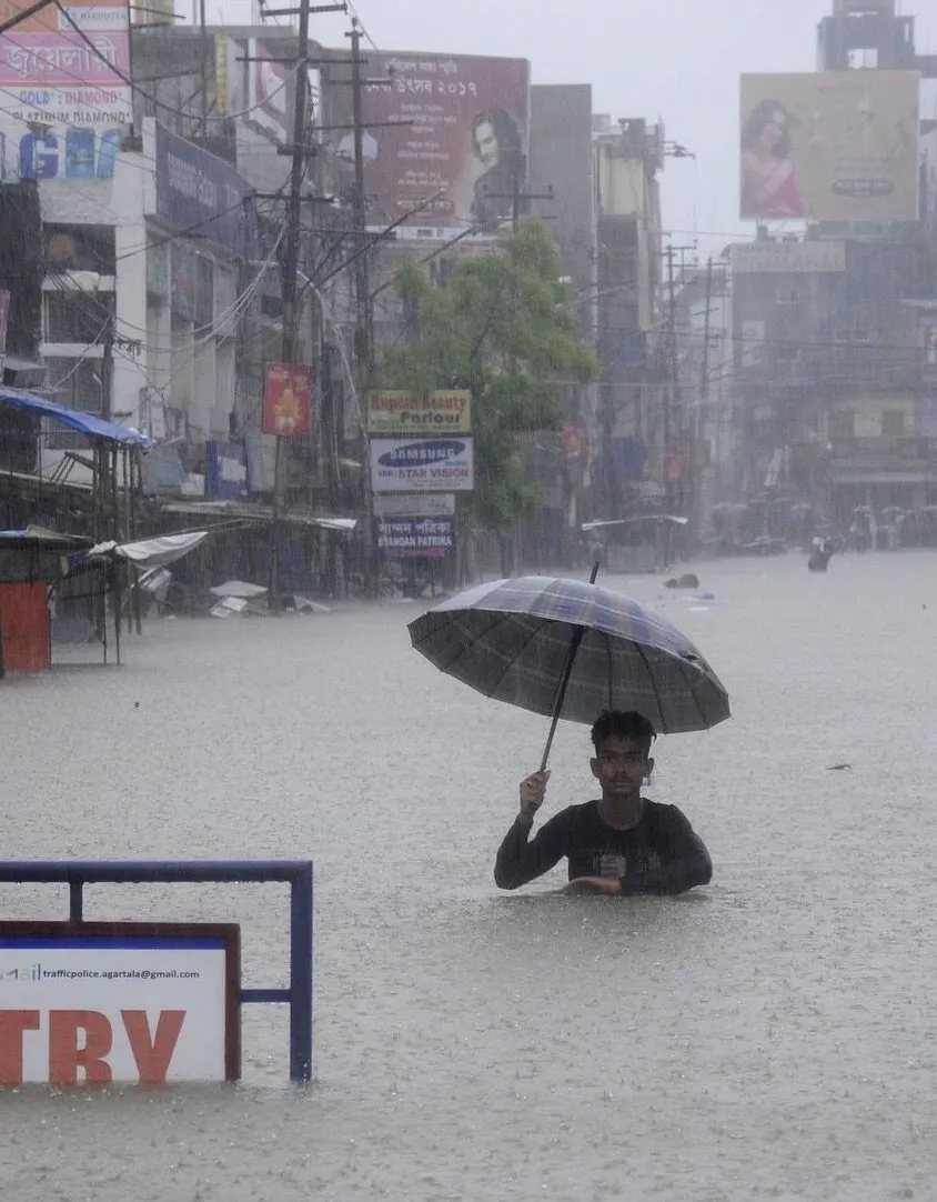
The nature of the recovery created a mixed picture on the ground. Areas that received intense, repeated downpours faced flooding and related disruptions. Other regions continued to experience rainfall deficits and pressure on water resources. This spatial unevenness is a recurring feature of the monsoon and complicates both agricultural planning and water management.
Reservoir storage and sowing progress improved in places that benefited from the July systems, yet the incomplete recovery in the east, northeast, and parts of the south meant that concerns did not disappear entirely. The overall seasonal deficit narrowed, but it did not vanish.
Lessons from the July Rebound
The 2026 experience underscores the limitations of monthly forecasts issued at the start of a period. While large-scale climate indicators provide useful guidance, the actual performance of the monsoon can shift rapidly when successive low-pressure systems develop and track favourably. The high number of low-pressure days in July proved decisive in overturning the earlier bleak outlook.
For farmers, water managers, and policymakers, the episode highlights the value of continuous monitoring rather than reliance on a single monthly projection. Early July rains already began reducing the deficit, and the subsequent systems extended that improvement. At the same time, the persistence of regional shortfalls shows that a national recovery does not automatically translate into uniform relief.
Looking Toward the Rest of the Season
By the end of July the monsoon had demonstrated both resilience and variability. The systems that rescued the month’s rainfall statistics also illustrated how concentrated and intense precipitation can become. As the season continued into August, attention remained on whether similar organised activity would persist or whether quieter periods would allow the cumulative deficit to stabilise or widen again.
The story of July 2026 is ultimately one of atmospheric dynamics overriding an initially pessimistic forecast. A dry June and a cautious outlook gave way to a month defined by repeated low-pressure systems, their westward tracks, and helpful interactions with other weather features. Those systems were the principal reason India moved from a substantial early deficit to a far more manageable position by the end of the month. The monsoon’s capacity for such rapid shifts remains one of its most consequential characteristics for a country that depends heavily on its performance.
Read more – cbdnets.com