Nepal Sought China Glacier Warnings Before Floods
Three months before a catastrophic flash flood devastated the Nepal-Tibet border region, officials from both countries sat down in Kathmandu to discuss the very risks that would later unfold. On 27 May 2026, roughly ten Nepali officials and about a dozen Chinese counterparts, including representatives from the Tibet region, met to strengthen cooperation on monitoring floods, severe weather and glacier-related hazards. The agenda prepared by the Nepali side called for joint risk-reduction measures, inventories of glacial lakes and hazard mapping. What followed revealed both the recognition of shared danger and the limits of existing information-sharing arrangements.
A Meeting Focused on Growing Risks
The May gathering reflected rising concern about the stability of high Himalayan glaciers and the potential for cascading disasters that cross the international boundary. Nepali participants emphasised the need for earlier and more detailed data on glacier movements, water levels and extreme events originating on the Chinese side. Sauhardra Joshi, a hydrologist at Nepal’s Flood Forecasting Division who attended the meeting, later explained the core request: if there were early movements of glaciers or related activity in the border area, Nepal wanted to know sooner so that downstream communities could prepare.
Chinese officials engaged in the discussions and, according to Beijing’s subsequent statements, shared important information in a timely manner. The Chinese embassy in Nepal described the talks as producing substantial progress on cross-border disaster information-sharing. Yet Nepali officials involved in the process said the volume and specificity of data received after the meeting fell short of what they had sought, particularly on glacier dynamics and real-time water-level changes that could signal an impending outburst or surge.
Warnings That Were Shared
China did provide meteorological alerts in the period leading up to the disaster. About a month before the floods, Chinese authorities began sharing forecasts of heavy rain over Tibet with Nepali counterparts through messaging platforms and email. Twelve days prior to 26 August, China’s World Meteorological Centre sent an email warning of a monsoon depression expected between 14 and 19 August. The message noted that enhanced rainfall was likely across much of Nepal and drew attention to the potential for secondary and cascading hazards, including landslides and flash floods.
These rainfall-focused alerts reached Nepali meteorological officials. What was not available, according to Nepali accounts, was continuous high-frequency data on glacier movement, upstream water levels or sudden morphological changes in the remote high-altitude zones that feed the Bhote Koshi and related river systems. The absence of a formal, binding real-time data-sharing agreement left both sides reliant on ad-hoc communication channels that proved insufficient for the speed of the eventual event.
The Disaster and Its Speed
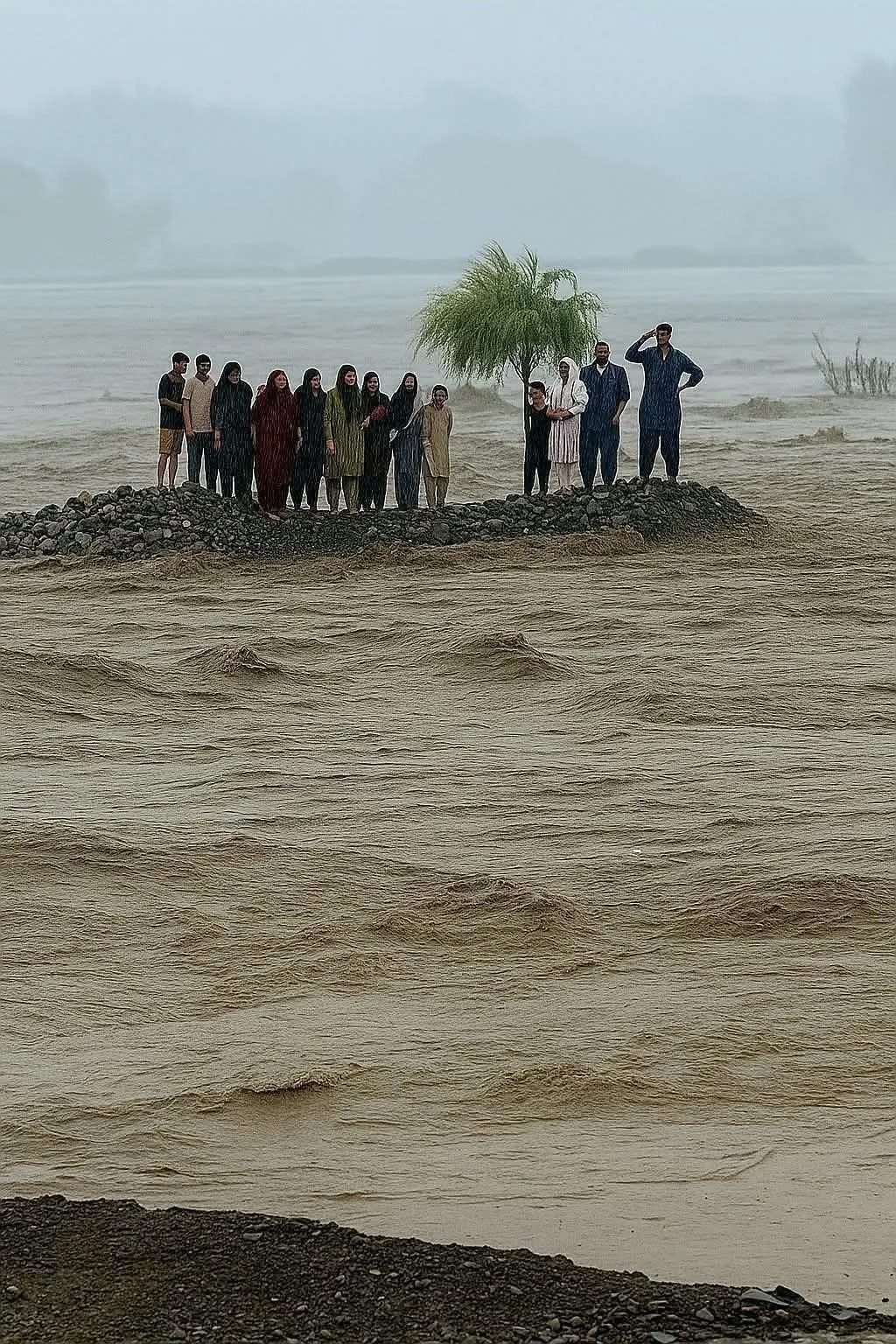
On the morning of 26 August 2026, a high-altitude glacier collapse—described by experts on both sides as an ice-and-rock avalanche—triggered a massive surge of water, mud and debris. The event affected the border region around Rasuwagadhi on the Nepali side and Gyirong on the Chinese side. Settlements, infrastructure and lives were lost within a very short window. Accounts from Nepali authorities indicated that the flood crossed into Nepal and advanced downstream with little opportunity for organised evacuation. In some descriptions, the time from the upstream trigger to impact on Nepali territory was measured in tens of minutes.
Nepal’s Minister for Science, Technology and Innovation later stated that no advance warning arrived from China because the disaster unfolded extremely quickly. He noted that within roughly half an hour of the upstream event the flood had reached Nepali areas, leaving insufficient time for effective response. Chinese officials maintained that monitoring remote, high-altitude terrain presents significant technical challenges and that they had shared available information promptly. They also rejected claims that a failure to warn had caused the scale of losses on the Nepali side.
Calls for a Stronger System
In the aftermath, Nepali officials have pressed for a more robust and formal early-warning arrangement. The goal is higher-frequency data—some officials have spoken of receiving updates as often as every ten minutes—on rainfall, river levels, glacier movement and related hazards so that downstream populations can be alerted in time. Nepal already maintains structured data-sharing practices with India on certain river systems; officials have indicated they would like a comparable mechanism with China focused on the northern border catchments.
The May meeting and the subsequent disaster have underscored a structural challenge in the Hindu Kush Himalaya. Many glaciers and upstream monitoring points lie in Chinese territory, while the populations and infrastructure most exposed to sudden floods often lie downstream in Nepal. Effective warning therefore depends on timely, detailed and trusted cross-border flows of information. Existing systems have issued alerts for some glacial and related hazards in previous years, yet the speed and nature of an ice-rock avalanche followed by a rapid debris-laden surge exposed the limits of current arrangements.
Technical and Practical Constraints
Chinese statements have highlighted the difficulty of continuous monitoring in extreme high-altitude and complex terrain. Satellite observation, ground sensors and field teams all face limitations in remote Himalayan zones. Even when data exist, converting them into actionable warnings that reach communities within minutes requires both technical infrastructure and pre-agreed protocols for rapid dissemination across a border. Nepal’s own monitoring stations in the affected corridor were themselves overwhelmed or destroyed by the flood, further complicating real-time assessment once the event was under way.
The two countries have continued contact since the disaster, including sharing of information on the barrier lakes that formed in the aftermath and posed secondary flood risks. Chinese teams conducted assessments of upstream water accumulation, and both sides issued public cautions about the possibility of further surges. These post-event exchanges demonstrate that communication channels exist; the outstanding question is whether they can be made fast, detailed and reliable enough to function before, rather than after, the next major event.
Lessons for Future Preparedness
The sequence of events—from the May meeting that explicitly addressed glacier and flood risks, through the limited data flows that followed, to the sudden catastrophe in late August—has focused attention on the practical requirements of transboundary early warning in a rapidly changing mountain environment. Climate-driven glacier instability increases the frequency and potential severity of such hazards. Without denser monitoring networks, formal data-sharing agreements and protocols that operate on the scale of minutes rather than hours or days, downstream communities remain highly exposed.
Nepali officials have framed the demand for more frequent and earlier glacier-related information as a necessary lesson. Chinese officials have emphasised that they already share information and face genuine technical constraints. Bridging the gap between these positions will require sustained technical cooperation, clear protocols and political commitment on both sides. The lives lost and the settlements erased in August 2026 have made the cost of incomplete arrangements starkly visible. Whether the next meeting produces a functional, high-frequency early-warning system will determine how well the region is prepared for the hazards that the May discussions already anticipated.
Read more – Instantdua.com